
Pottstown Block Record Sources
A block inquiry has different sources for different facts. The County map and property record can establish parcel geometry, parcel identity, and selected property context. The Recorder’s index can connect an identified parcel to a recorded transaction trail. Borough Area Maps give street, ward, and directory-map context, while the Borough Public Portal accepts defined location concerns. Historical directories and newspapers may provide dated address leads only after a real volume or item is inspected. None of those sources is a complete list of the people who live around an address.
| Source | What It Shows About a Block | Access |
|---|---|---|
| County map and parcel search | Parcel geometry, identity, and selected property context for individually chosen parcels | Montgomery County map search; do not assume an unverified radius tool |
| Recorder index | Recorded owner or transaction trail for a parcel that has already been identified | Public Access System account; images and copies may have charges |
| Borough Area Maps | Street, ward, and directory-map context | Pottstown Area Maps; not ownership data |
| Borough Public Portal | Location-based service and permit-concern channels | Pottstown Public Portal; not a parcel-neighbor directory |
| Hobart’s Run and local resources | Community geography and voluntary participation | Organization pages and the Borough resource directory, not membership rosters |
| Historical directories and newspapers | Date-specific occupant or address leads | PHS, PRPL, and Library of Congress materials; incomplete and historic |
That distinction prevents a common mistake. A property record may identify an owner relationship, yet it does not prove who occupies the parcel. The same is true of a tax mailing address. It is a correspondence detail when the record supplies one, not a verified home address or a statement about other household members.
Map Pottstown Parcel Records Carefully
The County’s Property Records map search is the official starting point for visual parcel work. The stronger Interactive Tax Map has search, share, zoom, pan, home, default-extent, and legend controls. At suitable scale, parcels appear as red outlines and address points as red circles or numbers. A selected parcel can expose a TAXPIN or alternate ID and a property-record link. County address-point data can also carry structured address and ZIP information, historical number or name, an address-change date, legacy-street, and neighborhood-community fields, but those are leads to cross-check against the legal record.
The County’s official parcel-map entry is shown here because it is the appropriate place to select an individual parcel before considering adjoining ones.
The County warns that parcel data and imagery are informational and visual. They may not align and do not replace a title search. A map result therefore identifies the parcel to investigate, rather than proving a title chain or identifying residents.
Note: Exact live layer names and adjacency controls were not captured, so a Pottstown block search should not be described as a radius search.
Trace a Pottstown Block Parcel by Parcel
Once the first property is selected, the adjacent-parcel method is deliberate and limited. Enter or select the initial parcel on the County map, pan or zoom to the outlined parcels next to it, and select each parcel individually. Use the parcel ID to open or cross-check the corresponding property record. This creates a parcel-by-parcel view of a block, not a prediction about the people inside each property. If the question expands to a whole named street and its current address records, the Pottstown Street Directory follows that separate, address-focused workflow.
- Find the starting address in the County map or County property search and record the parcel ID, property location, municipality, and available legal-description clues.
- Pan or zoom to an immediately adjoining outlined parcel, select it individually, and retain its parcel ID rather than relying on visual proximity alone.
- Open the property record to compare the selected parcel’s property context with the map result. Treat any owner mailing detail as correspondence information.
- For a recorded transaction question, carry the parcel ID, address, or party name to the Recorder and retain the instrument placement before moving to an earlier document.
Parcel, or tax-map, identifier means the County’s unique property reference. Situs means the physical property location. A legal description identifies the land through recorded lot, subdivision, metes-and-bounds, or other legal wording. Those terms are safer anchors than guessing from nearby street numbers.
Carry Pottstown Parcels to Recorded Instruments
When the map produces a parcel ID, the next source for an ownership or transaction question is the Montgomery County Recorder’s Public Access System. The office says a user creates an account, selects Search Public Records, and may search by name, address, parcel ID, and other criteria. The Recorder’s corpus begins September 10, 1784, but that date refers to the records corpus, not automatic free remote images or a full history of everyone who lived there.
For a recorded deed, note the grantor, grantee, recording date, document or book/page placement, property description, and any reference to an earlier deed. The public counter has computers for document searches. Remote viewing requires either a $25 calendar-day subscription or a $300 monthly subscription, while a remotely printed e-certified copy costs $10.50. A written mail request and the County Archives are additional routes when the online index does not resolve a historical question.
Recorded party names show a transaction or title context. They are not a household list. Keep the legal description and prior-reference language with every document so a chain does not jump to a different property with a similar address.
Pottstown Community Records Geography
The community layer is organizational, not a resident register. The Borough’s Residents page points to resources for civic organizations, schools, libraries, support groups, and foundations. Hobart’s Run is a nonprofit neighborhood initiative launched by The Hill School in 2016. It describes an approximately 900-parcel focus area and voluntary meetings and block-captain participation. The research did not locate an official member directory, HOA roster, block-watch participant list, or public household-neighbor index.
| Pottstown resource directory | Identifies organizations and local services, not their private member or household lists. |
|---|---|
| Hobart’s Run | Describes a voluntary community initiative and focus area, not a roster of homes or participants. |
| Pottstown Historical Society and Library | Offer dated historical collections that may support a specific address question after an actual item is inspected. |
Hobart’s Run’s description of its community work gives useful geography for a neighborhood inquiry without turning participation into a household directory.
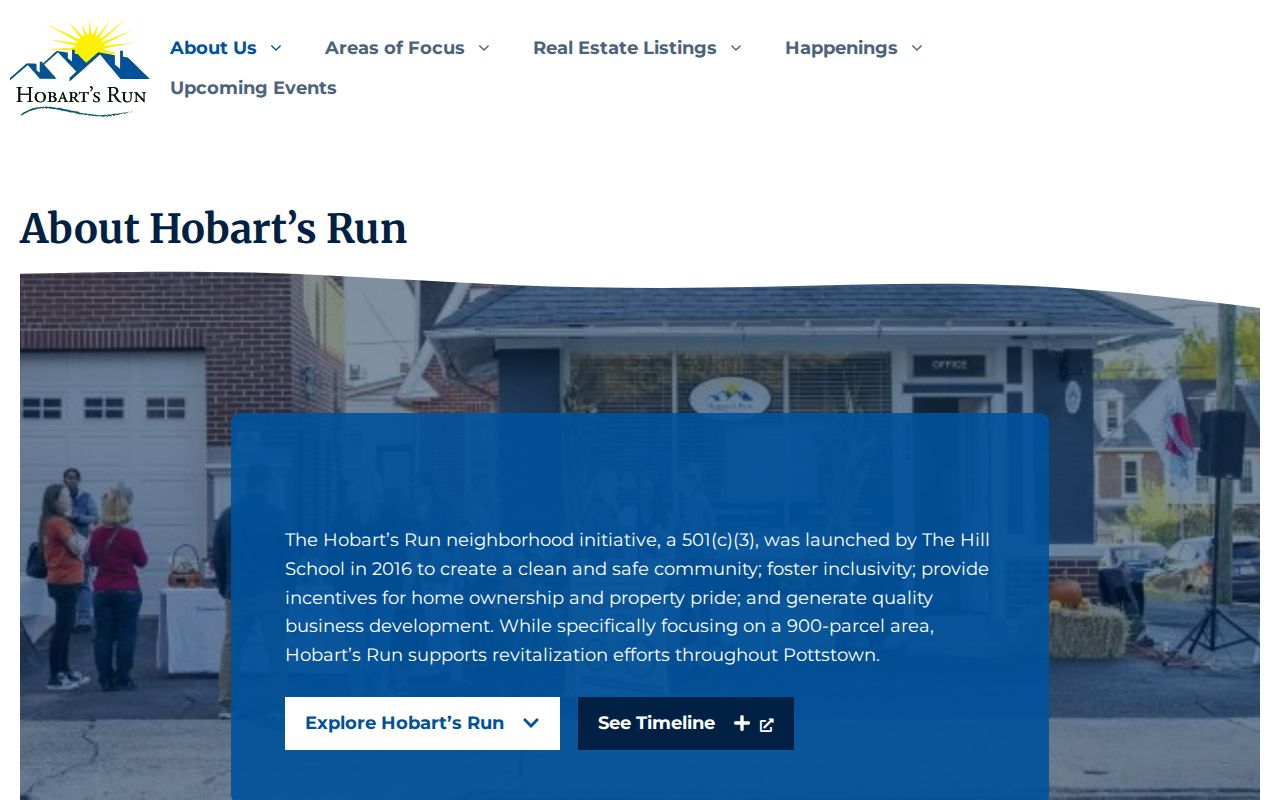
Use community information to understand the organizations and places connected to a block. Do not infer a person’s membership, attendance, or residence from a group’s presence in the area.
Use Pottstown’s Public Portal for Block Issues
The Borough’s Public Portal serves a different purpose from the County parcel map. It is a service-request gateway for property-maintenance and permit concerns. A location-specific report can direct a defined municipal issue to the Borough, but it does not yield an owner map, a residential list, or a way to browse the people around an address. For an administrative record, a specific Borough request should identify the address, date range, document type, and desired format.
The Borough Public Portal is pictured here as a location-concern channel rather than an online block directory.
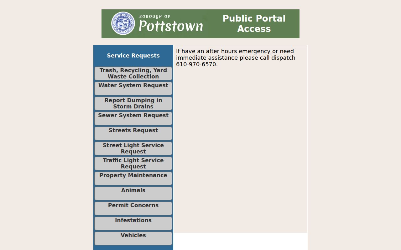
The portal’s value is practical block information about a defined concern. It should not be used to draw conclusions about the people connected to that location.
Pottstown Voter-List Record Boundaries
Pennsylvania law recognizes public inspection of certain registration-commission materials, including street lists, but it does not create an ordinary browseable block tool. Under 25 Pa.C.S. §1207, inspection occurs during business hours in the presence of a commissioner or authorized employee and may be regulated for safekeeping. Section 1404 requires identification and a written statement that public information lists will not be used for purposes unrelated to elections, political activities, or law enforcement.
The official request form offers defined products such as a Public Information List, Street List, Walking List, and Full Voter Export, with Montgomery County selectable. Each Montgomery County product is listed at $20. The form collects requester identity and contact information, selected product and county, a permitted-use attestation, and a signature. It also restricts Internet publication. Those rules make the voter path a controlled election-record process, not a source for reconstructing the residents of a Pottstown block.
Compare Pottstown Block Record Types
Official sources state what they represent and who maintains them. A commercial neighbor-lookup category may combine old, partial, or unmatched data, but it does not replace the County’s parcel selection, the Recorder’s recorded instrument, or a dated historical source. A result from any category needs confirmation from the actual custodian before it is treated as meaningful.
| Record Category | Useful Pottstown Question | Boundary |
|---|---|---|
| County map and property record | Which parcel is beside the starting address? | Informational parcel context, not title or occupancy proof |
| Recorder instrument | What recorded transaction or legal-property context belongs to the selected parcel? | Shows recorded parties and placement, not every occupant |
| Community resource | Which organizations or services operate in the area? | Voluntary-group information, not a member roster |
| Commercial information compilation | Can a tentative lead be checked against an original record? | Never a substitute for custodian verification or a reason to infer a household |
Privacy Rules for Pottstown Block Records
Public title and assessment facts do not identify renters, other household members, utility customers, delivery customers, protected ACP participants, or a complete block population. Pennsylvania’s Address Confidentiality Program permits eligible survivors to use a substitute mailing address in specified systems. Applications, actual addresses, and waiver proceedings are confidential. Court policy also excludes protected identifiers and categories from electronic public records. A missing record is not an opening to seek information through a different route.
Neighbor research is most useful for civic curiosity, reconnecting, family history, property questions, and personal safety awareness. It must not become surveillance. Pennsylvania harassment and stalking laws apply, and the legal limits around records should be honored even when an address is publicly visible.
Lawful use. Pottstown block research is limited to personal, lawful purposes. Using information to watch, stalk, harass, intimidate, or harm any person is prohibited.